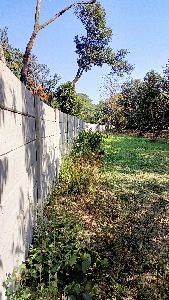
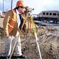
Boundary Surveyor
5,000 - 8,000 Per visit
A boundary survey is a specialized type of land survey conducted to precisely determine the legal property boundaries of a parcel of land. The primary goal of this survey is to identify and document the exact locations of property lines, corners, and any encroachments or discrepancies. This survey is crucial for legal, real estate, and development purposes and is often required before land transactions, construction projects, or property disputes. Key elements of a boundary survey include: Boundary Identification: The surveyor identifies and demarcates the existing property lines as specified in the deed or legal documents. Monumentation: Surveyors may set or restore boundary monuments, such as markers or pins, to physically indicate the corners and lines of the property. Research: The surveyor conducts thorough research, reviewing historical documents, deeds, and other relevant records to understand the legal description of the property. Adverse Possession Check: The surveyor checks for any potential adverse possession issues, which occur when someone unlawfully occupies a portion of the property over time. Encroachment Detection: The surveyor identifies any encroachments, easements, or overlapping boundaries that may affect the property lines. Plat or Survey Map: The results of the boundary survey are typically presented in a detailed map or plat, illustrating the property lines, dimensions, and any relevant legal descriptions. Legal Descriptions: Accurate legal descriptions of the property boundaries are provided to support legal and real estate transactions. Boundary surveys are critical for resolving property disputes, ensuring accurate property tax assessments, and establishing a clear understanding of property rights. They are conducted by licensed surveyors who adhere to professional standards and local regulations. The information obtained from a boundary survey is legally binding and serves as a foundation for property transactions, land development, and the resolution of boundary-related disputes.

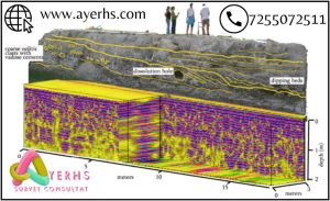
Ground Penetrating Radar Survey Service
Get Price Quote
A Ground Penetrating Radar Survey, commonly referred to as a GPR survey, is a geophysical locating technique that makes use of radio waves to take images of entities below ground level without digging up the soil. The GPR provides unprecedented insights and targets confidence to detect traditionally non-locatable subsurface features such as: Non-metallic pipes, including PVC and asbestos cement Underground Electrical Cable Concrete storm and sewer systems Utilities where installed tracer wiring has failed Underground storage tanks and drainage tiles Septic system components Non-utility structures such as vaults, foundation walls and concrete pads
Looking for Land Surveyor Service Providers

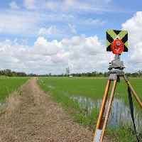
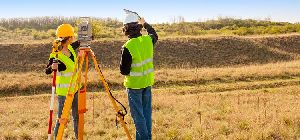
Agricultural Land Survey Services
Get Price Quote
land survey
Get Price Quote
The company has gained specialization in rendering the best Services for Land Survey. The Land Survey is conducted by using modern Total Station, GPS, and other techniques under the supervision of the expert professionals. These personnel perform Land Survey as per the strict rules and regulations as set by the competent bodies. Our Land Survey Service is offered at very competitive rates.

land survey consultancy service
250,000 Per Kilometer
Our team is well trained and highly qualified. We provide the best service avilable in the market. Contact our experts and get to know the details and price as per your requirements.
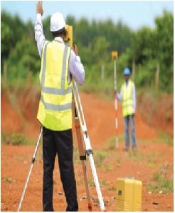
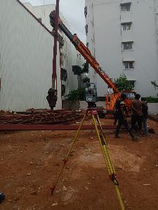
Land Surveying Services
Get Price Quote
Building surveys are one of the staples of the early stages of any architectural project .Surveyors don't just work outdoors they can survey the interior of homes as well. Issues like damp and rot can require surveys to be able to fully understand the extent of the damage.
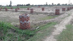
land plotting service
Get Price Quote
1000 Square Feet (MOQ)
Any one like to purchase Residential Plot, Commercial plot, in Gorakhpur , Kasia, Kushinagar Padruwana, Lucknow, and want to Purchase Flats in Delhi, Noida, and Duplex in Lucknow so kindly contact us.
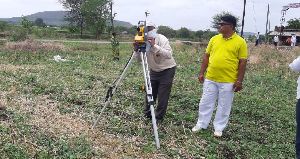
Agricultural Land Survey Service
Get Price Quote
Our company is well known in conducting various kinds of surveys for companies in need of it.

Land Acquisition Survey
Get Price Quote
we provide the best consultancy for preparation of land acquisition proposal and assistance for acquisition of land. the land acquisition survey services, offered by us, are carried out by our experienced personnel who have ample knowledge in this genre. our expert surveyors have complete knowledge of topography and provide service by making complete survey of the land along with mapping activities. the land acquisition survey services that we provide will include audit preparation, site identification, lease negotiations, planning assessments, consultancy for land purchase & sale, mutation and conversion, etc.
land surveying service
Get Price Quote
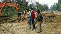
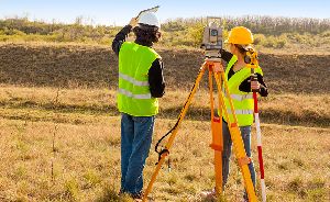
Priya Agencies, Maharashtra provides you with a wide variety of land surveying services for private and public sector clients. From the construction layout of high rise steel structure to 3D laser scanning, we perform comprehensive surveying services for residential and commercial developments, buildings, highways, utilities, bridges, waterways and property acquisitions. Our experienced staff of land surveyors use state of the art equipment and practical innovation to reduce the costs of survey and expedite the completion of projects while maintaining a superior product for our customers and clients. We consistently apply unique approaches using the latest technologies to provide quality and timely services, no matter the size of the projects. Our licensed professionals and skilled technicians serve a diverse client base which includes state and federal agencies, local governments and much more. Therefore choose us and get our services.

land survey consultancy service
8,000 Per Kilometer
10 Square Meter (MOQ)
Land survey, road survey,boundary survey, all types of surveying using total station ..

Land Surveying Services
Get Price Quote
Based in Rajasthan, HRD Groups is the prominent Land Surveying Services Provider. The company functions with the help of expert professionals who are seasoned in providing Land Surveying Services with full dedication and passion to fulfil the various needs of clients in an appropriate manner. Land Surveying Services involve accurate survey for small scale, large scale mapping and infrastructures projects using the DGPS, Total Station and LiDAR Technologies. Types of surveys : Topographical survey Highway Surveys Irrigation project surveys Cadastral surveys Layout and Building Markings Hydrographic surveys
Land Survey Services
Get Price Quote
Land survey includes the measurement of properties sold or purchased. And, if you’re looking for a reliable name to handle this requirement, get in touch with us. One of the leading names in the industry, Latest Cads & Graphics is actively involved in providing land survey services in and around Gurgaon (Haryana, India). We are backed by a pool of professionals, surveyors and workers, who work cordially and make sure that the undertaken task is timely delivered. Our service charges are also reasonable.
topographical land survey
Get Price Quote
SURVEY TOPOGRAPHIC : Alignment Survey for Transport Corridors, Utility Corridors, Canals, Oil, Gas, and Water Pipe Corridors. River Basin, Catchments, Industrial,Commercial and Urban Zones. PLAIN TABLE AND CONTOUR : Housing, Industrial, Transport, Irrigation & Water Resources. GIS : Geographical Information System Using Satellite Imagery, DGPS, GPS. MARINE SURVEY : Water Depth Evaluation, River / Nalla / Water Body Profiles. FIELD STUDIES CADASTRAL SURVEY : For Land Use / Size and Ownership Details. Demographic Survey. CONSTRUCTION MATERIAL SURVEY : For Housing, Commercial, Industrial Projects. ANALYSIS & SPECIAL REPORTS : Generation of 3D Digital Terrain Maps, Digital Contour Maps, Earthwork Estimation Schedules (Based On 3D), Transport Corridor Geometrical (Horizontal & Vertical) Designs, Satellite Maps. Projects executedTownships, Special Economic Zone. Irrigation Projects, Road, Highway & Bridge Projects, Industrial Projects, Route Alignment for Various Utilities.
Land Surveying Services
Get Price Quote
Nayak, Nayaks & Associates is engaged in offering the best quality services of Land Surveying Management. Land is an important variant for the construction of any kind of building. A strong, durable and useful building depends upon the quality of land on which it is being constructed. The quality of soil, the topical atmosphere around the land, shape, size etc.; all these plays an important role for the construction of a building. An in depth analysis of different factors affecting the land is done by our experts. The steps involved for any land survey include the study of the shape of the land, area of the land and the spot level in respect to the approached road. The shape of the land is a determinable factor for the construction of any kind of building. Area also plays vital role for the spread and size of any building. Accessibility with respect to the significant location is also taken consideration in case of the land survey.
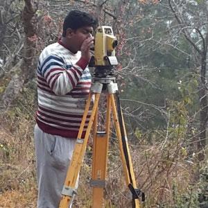
Land Surveying
Get Price Quote
Govt. Certified Land Surveyor, making Layout & Demarcation of Land, doing various Project Survey and making Report with detail Drawing
Ground Penetrating Radar Survey
Get Price Quote
Ground Penetrating Radar Survey, dgps survey

land survey
Get Price Quote
road,land,properties,pipe line & dgps survey.
land plotting survey service
Get Price Quote
land plotting survey service, land surveyor, Land Survey Consultancy

Ground Penetrating Radar Survey Services
45 Per MTR
Ground Penetrating Radar Survey Services, gis mapping services