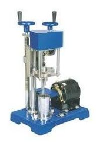
Vane Shear Apparatus
Quality being the sole concern, we offer functionally updated array of Vane Shear Apparatus that are quality assured and are corrosion resistant in nature. Our entire product range has high shear strength and is performance based. The Vane Shear Apparatus are known for their quality assurance.
...more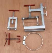
transmission tools
We believe in discharging our services ourselves. We neither outsource our work to a third party, nor do we perform with tools and equipment hired or borrowed from a third party. In the same vein, we never lend our equipment to others on hire.
...more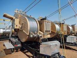
transmission line equipments
We manufacture different range of the transmission line equipments. These are used in the various power and electric transmission line towers.
...more
Ground Penetrating Radar
We are offering ground penetrating radar (gpr) is a totally non-destructive technique to produce a cross section profile of subsurface without any drilling, trenching or ground disturbances. The profiles are used for detecting buried utilities, such as, pipes, cables, etc in totally non-destructive manner. Additionally, subject to requirements, we also use cable & pipe locators, and for precise definition of locations, we use dgps and electronic total stations. The system operates by detecting subsurface changes in em properties (dielectric permittivity, conductivity, and magnetic permeability) which in a geological setting are functions of soil and rock material, water content, and bulk density. Data is acquired by transmitting high frequency electromagnetic (em) signals into the ground which are reflected from various boundaries possessing em property contrasts. The equipment receives the reflected waves over a selectable time range and displays them in real time on screen. The reflected wave data is also saved in appropriate memory for later processing and interpretation. Gpr measurements are used in geologic, engineering, hydrologic, and environmental applications. The company provides the following services using gpr: (a) mapping geologic conditions, such as, depth to bedrock, depth to water table, depth and thickness of soil strata on land and under fresh water bodies, location of subsurface cavities and fractures in bedrock. Mapping landfills and trench boundaries, and contaminants (b) location of buried utilities, such as, pipes (metallic and non-metallic), electric cables (induction locator is further used to identify live cables), drums, tanks, sewers, and boulders. (c) conducting investigations for archaeological and forensic applications. (d) conducting studies, such as, roads and railroad track-bed studies, and highway bridge scour studies. (e) inspection of brick, masonry, and concrete structures.
...more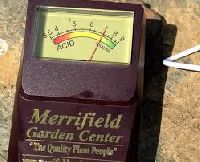
Soil testers
Soil profiles, as we know, vary considerably from one location or region to the next, depending on geology, hydrology and climate.Hence, soil testing becomes an essential part of a fertility program and to profitable crop production.
...more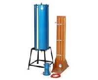
Soil Permeability Apparatus
Same as ZI 3030 but with glass tubes of 75mm, bore tube is provided with overflow arrangement for constant head tests. The remaining tubes are used for falling head test.
...more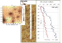
Seismic downhole test
We are offering seismic downhole test. This method is applied for determination of the interval velocities from arrival times and relative arrival times of compression (p) and vertically (sv) and horizontally (sh) polarized shear (s) seismic waves which are generated near surface and travel down to an array of vertically installed seismic sensors. The method provides accurate in-situ p and s wave velocities essential for use in geotechnical foundation designs. The results are used in analyses of soil behavior in both static and dynamic loads where elastic constants are input variables into the models defining different states of deformations such as elastic, elasto-plastic, and failure. Another use of estimated shear wave velocities in geotechnical design is in liquefaction assessment of soils.
...more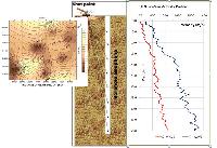
Seismic cross hole test
We are offering seismic cross hole test. The seismic cross-hole survey yields detailed measurements of in-situ compressional and shear wave velocities in cased boreholes typically spaced 3 to 6 m apart. The cross-hole survey provides information pertinent to the seismic wave velocities of the material in question. These velocities are used as input into site specific static dynamic analyses, or for computing shear modulus, young’s modulus, and poisson ratio for material characterization or for determination of vertical and lateral heterogeneity existing at site. Seismic cross-hole survey uses two or more boreholes to measure wave propagation velocities along horizontal paths. The simplest cross-hole survey configuration consists of two boreholes, one of which contains an impulsive energy source and the other a receiver. By fixing both the source and the receiver at the same depth in each borehole, the wave propagation velocity of the material between the boreholes at that depth is measured. By testing at various depths, a velocity profile can be obtained. When possible, use of more than two boreholes is desirable to minimize possible inaccuracies resulting from trigger time measurement, casing and backfill (material placed between the casing and the borehole wall) effects, and site anisotropy.
...more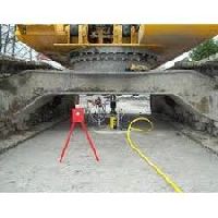
Plate Load Test Equipment
Plate Loading Test Set consists of a 500 kN capacity piston assembly and hydraulic hand pump, pressure transducer, LPI battery operated digital readout unit, 2.4 m long datum bar, 3 pcs. 25 mm travel x 0.01 mm digital dial gauges with dial supports, 300 mm, 450 mm, and 600 mm loading plates. It is also used for load tests of soil and flexible pavement components for use in evaluation and design of airport and highway pavements.
...more
geotechnical equipment
GGPL also offers services for ground improvementslope protection work. The ground improvement slope protection work is performed either for natural landslide or manmade vertical steep excavation for underground basement work, where there is no space for excavation in stabilized slope. Such services are performed using appropriate techniques like SoilRock Nailing, Piling, Shotcreting and Grouting.
...more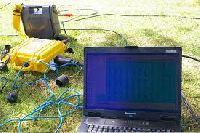
Geophysical Equipment
We believe in discharging our services ourselves. We neither outsource our work to a third party, nor do we perform with tools and equipment hired or borrowed from a third party. In the same vein, we never lend our equipment to others on hire.
...more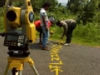
geodetic surveys
We are offering geodetic surveys are conducted for various end uses, such as, route alignments, laying of transmission line and pipeline, 2d3d seismic exploration, and so on. Some of the geodetic survey services offered by the company are: route alignment survey: it is conducted for proposed routes of transportation and communication, such as transmission lines, pipelines and tunnels. At least three alternative route alignments are surveyed, out of which one is selected as the most optimum alignment. Detailed route survey: it is conducted using modern survey techniques for the optimum route alignment selected. Route marking and profiling is done using total station dgps and reference levels are recorded along the route. The complete profiling details are digitized and computer aided tower spotting is carried out. Engineering design: profiling and tower spotting are carried out using pls-cadd software. Construction survey: examples of construction surveys are highway pre-construction, construction and post – construction surveys• topographic survey: it is conducted for various geological and geophysical exploration surveys such as 2d3d seismic surveys, gravity surveys, geological mapping, etc• contour survey:it is conducted for land and water bodies
...more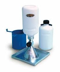
Field Density Apparatus
Field Desity Test Apparatus Core Cutter method (Core Cutter Dolly with Hammer) consisting of a core cutter 100m internal diam , dolly for use with above and metal rammer for driving core cutter.
...more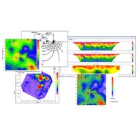
Electrical Resistivity survey
We are offering electrical resistivity survey. Dc resistivity techniques, sometimes referred to as electrical resistivity (er), electrical resistivity imaging (eri) or vertical electric sounding (ves), measure earth resistivity by driving a direct current (dc) signal into the ground and measuring the resulting potentials (voltages) created in the earth. From that data, electrical properties of the earth (the geo-electric section) can be derived and thereby the geologic properties inferred. The technique consists of driving two electrodes into the earth to supply current to the ground. Two additional electrodes are used to measure the earth voltage (or electrical potential) generated by the current. Depth of investigation is a function of the electrode spacing. The depth of investigation is generally 20% to 40% of the outer electrode spacing, depending on the earth. The resistivity data is then used to create a hypothetical model of the earth and its resistivity structure (geo-electric sections). If borehole data or a conceptual geologic model is available, then a geologic identity can be assigned to the geo-electric units. A two-dimensional geo-electric section may be made up of a series of one-dimensional soundings joined together to form a two-dimensional section. The type of section produced depends on the acquisition parameters and the type of processing applied to the data. Electrical resistivity tomography is carried out using multi-electrodes spaced at desired intervals along a linear profile.
...more
Seismic Refraction Survey, Seismic Crosshole Survey, other Seismic Tests
we are service providers of seismic refraction survey, seismic crosshole survey, other seismic tests etc.
...more
Boundary Survey

ground penetrating radar surveys

land survey

Route Survey

seismic crosshole testing

seismic refraction surveys

Topographic Survey

underground utility surveys

radar surveyor

seismic refraction surveyor

electrical resistivity surveyor

topographic surveyor

Building Layout Survey Service

positioning surveyor

consultancy surveyor services
Be first to Rate
Rate ThisOpening Hours